Copeland Finishes a Mobile, Interactive Map of Schoolcraft’s Journey
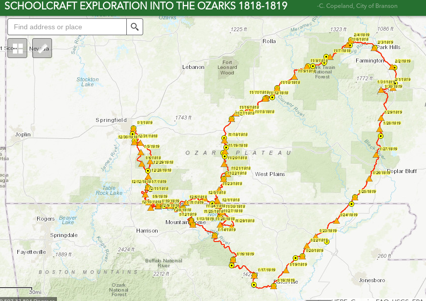 Curtis Copeland, the Geographic Information Systems (GIS) Coordinator for the City of Branson, one of the founders of the Society of Ozarkian Hillcrofters (second generation), and a member of the informal group of representatives from various cultural memory institutions in the Ozarks who are planning events, publications, and resources to commemorate and celebrate the 200th anniversary of Henry Rowe Schoolcraft’s exploration of the Ozarks, recently completed and made available at no charge to the public a mobile, interactive map of Schoolcraft’s journey back in late 1818 and early 1819. The map is powered by ESRI.